


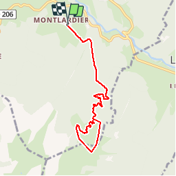

13.1 km | 24 km-effort


User


FREE GPS app for hiking
 SityTrail
IGN / Geographical institutes
SityTrail World
The world is yours!
Trail Walking of 8.6 km to be discovered at Auvergne-Rhône-Alpes, Savoy, Le Châtelard. This trail is proposed by michmich.

Walking
Walking

Walking

Touring skiing

Walking

Walking

Walking
Walking

Walking
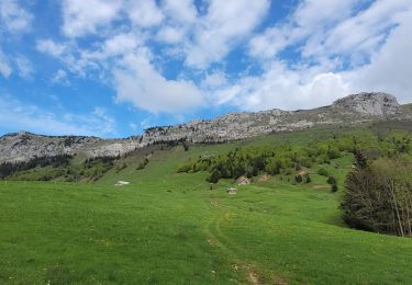
la boucle n est pas balisée dans les alpages
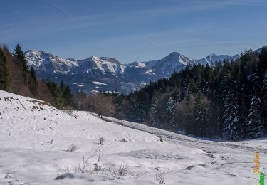
conforme à la description Alpages très agréable et très belle vue sur le ChâtelardTrès bien pour se mettre en jambe